Trail number
Not applicable
Trail length
25 kilometres
Elevation variance
45 metres
Trail type
Single trail, motor bike track, fire trail, gravel road and bitumen road
Trail surface
Smooth dirt, rocks and rock outcrops
Weather affected
All weather
Trail condition sources
Nil
Trail features
Rough natural trails, chances to explore side trails
Trail obstacles
Nil

Trail rating
Intermediate
Rating basis
Estimated
Night riding
Yes.
Family Friendly
Younger MTBers could readily ride this course as long as they have a reasonable level of riding confidence. Rated intermediate due to length of ride. Sections along river can readily be ridden by younger riders to build their skills.

Click Image For Trail Map
No GPX download
This ride is based on the Grunge Gully ride in Kieran Ryans Off Road Cycling Adventures 2nd Edition. It starts at Cranwell Park which is located at the end of Lacy Street, Braybrook but it can be extended all the way down the Maribyrnong to the Newport area using the bike network trails if you want to go even further. The route is shown below.
The first part of the ride follows the southern bank of the Maribyrnong through a mix of dirt tracks, single trail, concrete paths , 4WD tracks and the like. Getting closer to the Western Ring Road, the area opens up to a 4WD and motor bike wonderland with trails going every which way so you could spend a bit of time mucking around in here.
You then head to the south western end of the EJ Whitten bridge to get to the north side of the river (using the bike track on the bridge) before using the Maribyrnong Trail to access Brimbank Park. This is largely a good gravel surface until it hits the even better bitumen paths in Brimbank park.
Note that since writing this, I have been told that the southern bank of the river also has some single track past the EJ Whitten bridge so that's a more MTB friendly route and this has been confirmed on Strava heat maps.
You can then do a large loop through Brimbank Park heading up to a lookout before dropping back down into the park and heading back to the start point along the northern bank of the Maribyrnong. Inside Brimbank park, follow the trails on the same side of the river until you get to the ford to the northern side of the river. Pick up the trail immediately on the left after crossing the ford behind the houses and follow it around until you pick up a footbridge and ford returning you across the river. Have a look at the video for some visual cues.
The nice thing about this ride is that you can mix it up a bit as the northern bank trail could be used by younger kids getting used to gravel trails and you could just ride this half of the circuit. If you want more MTB like country keep on the south side of the river while heading out to and on the way back from Brimbank Park or do a bit of both to mix it up. Whilst it's not completely MTB territory, it is a good little circuit to do close to town and it's certainly not a road bike trail.
Note the GPS map below has missed tracking the southern bank part of the route in between Lacy Street and the Western Ring Road. It basically follows the same sort of route along the river bank. With respect to the map below, the track starting at Lacy Street (at the bottom of the map) shows you heading right at the river. To access the southern bank ride, just turn left at the river below Lacy Street. If unsure look at the video and you'll get the idea.
 |
 |
 |
|---|---|---|
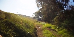
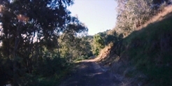
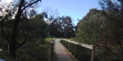
First section leading up to Western Ring Road. Quite a varied mix of trail types from concrete to single trail. |
||
 |
 |
 |
|---|
 |
 |
 |
|---|---|---|
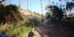
Heading up south embankment to bike lane on bridge. Cross to north side, turn left and follow down to river. |
||
 |
 |
 |
|---|
 |
 |
 |
|---|---|---|
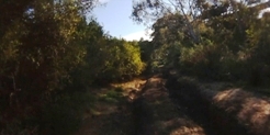
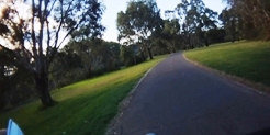
Follow trail west to Brimbank Park, through Brimbank Park and across ford. |
||
 |
 |
 |
|---|---|---|
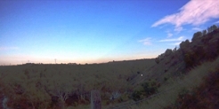
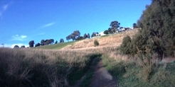
Turn left at top of ford and follow trail up to lookout and back down to river. |
||
 |
 |
 |
|---|---|---|
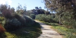
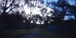
Follow trail around keeping a lookout for trail to ford on the left. Cross river and follow the trail back towards where you started from and keep to northern bank of river. The northern bank is easy gravel track so you do have the option of heading back to the southern side for something a bit more MTB like. |
||
 |
 |
 |
|---|
 |
 |
|
|---|---|---|
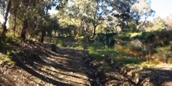
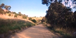
Follow trail, cross at pipe bridge and then head west back to Cranwell Park |
||
 |
Parking is available at Lacy Street, Maribyrnong and at Brimbank Park. |
|---|---|
 |
Toilet facilities are available at Brimbank Park. |
 |
Drinking water is available at Brimbank Park. |
 |
No food or drinks are available in the immediate area. |
 |
No local information facilities are available. |